display:none;">
Subscribe to TourNews

  • 398 Users viewed this
  • 0
    Download GPS data (0 downloads)
  • Full map view
  • Plan in RidePlan
  • Reverse tour
  • Show distance and time
  • Show distances
  • Show the entire Tour on the map
  • Download PDF
  • Print actual view
  • Ride with friends
    Let us ride this tour on:
    Add some friends so you can share the tour with them
  • 0
    E-mail GPX file
    Please add some friends so you can send the GPX file of tour to them
    Send copy to me
  • Report
  • Embed
Scenic
Mountain
Seaside
Twisted
Straight
Duration:
7h 37 min
Distance:
281 mile
Rating:
Website:
http://
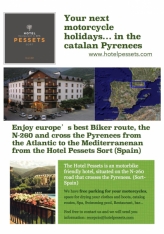
Hotel Pessets&Spa, has the following proposal for you to enjoy both from driving and what our land can offer you:

This is a 453 km route that starts from Sort, following one of the best roads of the catalan pyrenees, the N-260.
It crosses a part of the the catalan Pyrenees in the province of Lleida and Girona. It is a intensive but popular and funny route, complemented by spectacular and different views.
If you are provisioned with a good supply of food and drink, this route will offer bikers the chance to enjoy the exhilarating experience of the catalan pyrenees in a single day. But if what you are searching for more relax and comfort, on the road there are many good restaurants with local cuisine.
 
As mentioned, the startpoint is in Sort — Hotel Pessets:

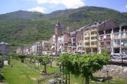
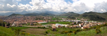
Sort, with its 2230 inhabitants, is the capital of the region.
Its main tourist attractions are its nature and the River Noguera Pallaresa, with adventure sports like white water rafting, canyoning, kayaking… It has also recently become famous for its lottery centre «La Bruixa d'Or» (Golden Witch), with many people stopping off here to try their luck.

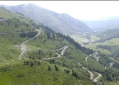
Take the N-260 in direction La Seu d'Urgell getting thorugh the Port del Cantó mountain pass.
The Port del Cantó is a mountain pass of 1718.4 meters located at the border of the municipalities of Soriguera, the region of Pallars Sobira and Montferrer i Castellbò, the region 's Alt Urgell.

La Seu d'Urgell is the capital of the comarca Alt Urgell, head of the judicial district of la Seu d'Urgell and the seat of Bishop of Urgell, one of the Andorra co-princes. It is in the district of Alt Pirineu i Aran (High Pyrenees and Aran), and is the town with the most inhabitants, having 17.4% of the district population. La Seu d'Urgell and Puigcerdà together have 30% of the population of the area.

It is located at the confluence of the Segre and the Valira rivers. The city is in the local region of Urgellet, a Pyrenean region formed by 16 municipalities of Alt Urgell. Urgellet and Andorra were the originary County of Urgell with capital in la Seu d'Urgell before the county expansion to the south. Alt Urgell is the gateway to the state of Andorra and the proximity to this important population center and economic activity is largely one of the reasons for the current drive of the city of la Seu d'Urgell within Alt Pirineu i Aran.

The town's patron saints are Saint Ot of Urgell,[9] Saint Sebastian, and the Virgin of Urgell. While the Virgin of Núria and Sant Ermengol are the main patrons of the diocese of Urgell. Sant Ermengol is the most prominent in the city than other patrons. Probably that's why there are various events throughout the year dedicated to Sant Ermengol, such as the Sant Ermengol Fair, one of the oldest in Catalonia, and the altarpiece of Sant Ermengol.

The Parc Olímpic del Segre, built in 1992 for the Barcelona Summer Olympic Games, is a pump-driven canoe and kayak sports venue located adjacent to the historical centre of la Seu d'Urgell.


Bellver de Cerdanya is a town in the comarca of Cerdanya with 1.314 inhabitants.
Places of interest:
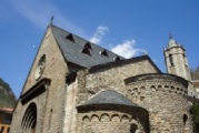
In Baltarga, the Romanesque church dedicated to St. Andrew (11th century, with two side chapels attached in 18th century);
In Bor, the Romanesque church dedicated to St. Marcellus (11th century);
in Coborriu de Bellver, the Romanesque church dedicated to St. Serni, first mentioned in the 10th century, suffered fire and destruction by the French in 1793 and during the Spanish Civil War in 1936; it was restored in 1967;
in Cortàs, the Romanesque church of St. Polycarp (12th century);
in Éller, the Romanesque church of Santa Eulalia (12th century);
in Pedra, the Romanesque church of Santa Julia, ransacked by the Albigensian in 1198 and modified in the 15th century after an earthquake;
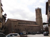
in Pi, the Romanesque church of Santa Eulalia, vastly modified in the 18th century; only the lateral walls and the bell tower belong to the original structure;
in Sant Martí dels Castells, the Romanesque chapel of St. Martin built inside the castle; its slightly pointed vault was rebuilt during Gothic times;
in Santa Eugènia de Nerellà, the only original structure of the 10th century Romanesque church is the bell tower, heavily tilted towards southeast;
in Talló the 11th century Romanesque church of Santa Maria; its bell tower was built in the 17sup>th century;
in Talltendre, the 12th century Romanesque church of Sant Iscle and Santa Victoria; its bell tower was built later.


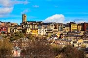
Puigcerdà  is the capital of the Catalan comarca of Cerdanya, in the province of Girona, near the river Segre and on the border with France (it abuts directly onto the French town of Bourg-Madame).

It is located near the site of a Ceretani settlement, which was incorporated into Roman territory. The Roman town was named Julia Libyca.
Puigcerdà was founded in 1178 by King Alfonso I of Aragon, Count of Barcelona. In 1178 Puigcerdà replaced Hix as the capital of Cerdanya. Hix is now a village in the commune of Bourg-Madame, in the French part of Cerdagne.
It was unique during the Spanish Civil War in having a democratically elected Anarchist council. The Portet-Saint-Simon–Puigcerdà railway was opened in 1929, crossing the Pyrenees to France.


Main sights:
Puigcerdà Pool
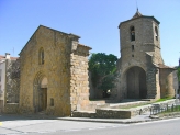
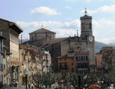
Torre del Campanar (12th century). It is the last remain of a parish church destroyed in 1936
Romanesque church of Sant Tomàs de Ventajola, known from 958
Romanesque church of Sant Andreu Vilallobent, dating to the 10th century and later restored
Convent of St. Dominic, founded in 1291 and finished in the 15th century
Old Hospital (1190), in Romanesque-Gothic style


Ribes de Freser is a municipality in the comarca of the Ripollès in Girona. It is situated at the confluence of the Freser, Rigard and Segadell rivers, 14 km (8.7 mi) north of Ripoll. It is known for its mineral water, paper manufacture and milk products, and is also an important tourist centre. A rack railway runs from the town to Queralbs and to the shrine of Núria, through the Vall de Núria. The town is on the communication route from Barcelona to Puigcerdà (N-152 road and RENFE railway line).

Ripoll is the capital of the comarca of Ripollès, in the province of Girona, Catalonia, Spain. It is located on confluence of the Ter River and its tributary Freser, next to the Pyrenees near the French border. The population was 11,057 in 2009.

The first traces of humans inhabiting the area date from the Bronze Age and can be seen in form of dolmens such as those found in El Sot de Dones Mortes or in Pardinella. This area was later used by peoples from the Atlantic culture to store bronze weapons and as a passway from the Catalan Central Depression to the Pyrenees. The area also has tombs from the late Roman occupation age and some belonging to the Visigoths.

It has a famous Benedictine monastery built in the Romanesque style, Santa Maria de Ripoll, founded by the count Wilfred the Hairy in 879. The count used it as a centre to repopulate the region after conquering it. In the High Middle Ages, its castle, the Castle of Saguardia, located in the county of Les Llosses was ruled by the Saguàrdia family, of which Ponç de la Guàrdia was a famous troubadour.

An abundance of coal and iron ore, coupled with the ample water supply of the rivers Ter and Freser, encouraged a metal-working industry in the early Middle Ages. The furnaces of Ripoll were a prime source of nails for the peninsula. Later, pole arms and crossbows, always in demand, were added to Ripoll’s exports. Ripoll enjoyed a reputation throughout Europe for the production of firearms. That success as a manufactory of firearms brought frequent trouble to the city. French invasions in 1794, 1809, 1812, and 1813 crippled the city industries. However, the final and utter destruction of Ripoll, resulting from mines and blasting, occurred in 1839 during the Carlist Wars. Due to the loss of records and archives, not much is known of Ripoll and its industry to this day.

Sant Joan de les Abadesses is a town and municipality located in the south-east of the comarca of Ripollès and it is located along the upper part of the River Ter, in the valley of the same name, and enclosed by the Serra Cavallera to the north and the mountain of Sant Antoni to the south. It has an inland, continental climate, with abundant precipitation and notable temperature variability.
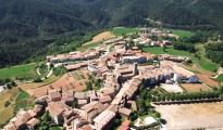
Main sight: The city of Olot has a rich cultural heritage. There are several fine examples of Modernist architecture and the «Claustres del Carme», the Carmelite Cloisters, which date back to the Renaissance.
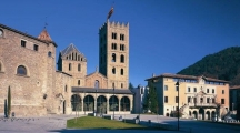
Monastery of Sant Joan de les Abadesses, founded in the late 9th century, with the current Romanesque complex built in the 12th century.
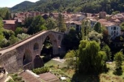
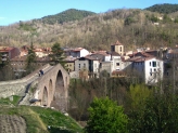
Pont Vell, or «Old Bridge», built in the medieval era and in the Gothic style.
Vila Vella, planned city built in the 13th century. It conserves its street layout, Main Square, and several houses from the 17th century.
Remains of the Medieval walls, including two extant towers, and parts of the wall itself.
«Way of Iron and Coal» (Ruta de Ferro i Carbó), a rail trail along the former railroad bed.


Olot is the capital city of the comarca of Garrotxa, in the Province of Girona. The city is known for its natural landscape, including four volcanoes scattered around the city center. The municipality is part of the Garrotxa Volcanic Zone Natural Park. Olot is also well-known for its cultural activity, with historical art movements like Olot school or imaginery schools, which contributed to the location in the city of the main Design and Arts & Crafts school of the province of Girona, the Escola d'Art i Superior de Disseny d'Olot.
With regard to painting and sculpture, the importance of the «Olot School» should not be left out. This artistic movement is well represented in the Museu Comarcal de la Garrotxa (the regional museum). Painting, sculpture and ceramics being the key elements in the art of Olot, not to mention the tradition of the Nativity Scenes or «pessebres» and the world famous sculptures of saints.
Nowadays the Olot Art School exists as a design and arts schools with the name of Escola d'Art i Superior de Disseny d'Olot and occupies the «Claustres del Carme» mentioned above.

Turn back to Ripoll taking the N-260a.
After Ripoll you will arrive to Borredà.
Borredà is a municipality in the comarca of the Berguedà. It is situated in the upper valley of the Margençol river in the east of the comarca. There are several notable houses from the 17th and 18th centuries. The Romanesque church of Sant Sadurní de Rotgers, a protected historico-artistic monument, can be reached by a mountain track. The village is served by the C-149 road between Berga and Sant Quirze de Besora. The municipality surrounds an exclave of Les Llosses.

Berga is the capital of the comarca of Berguedà.

Berga derives its name from the Bergistani, an Iberian tribe which lived in the area before the Roman conquest. The Bergistani were first subdued by Hannibal in 218 BC. They rebelled twice against the Romans and were twice defeated; after their second uprising, much of the tribe was sold into slavery. Livy mentions their principal town, Castrum Bergium, which was probably the precursor of the present-day town of Berga. It was ruled by viscounts in the Early Middle Ages and had its own counts from 988 and was sold to king Peter II of Aragon in 1199.
Berga is perhaps most famous for its traditional festival of «La Patum», a celebration which occurs every Corpus Christi, lasting for five days.
Valls is the capital of the comarca of Alt Camp, in Catalonia, Spain. According to the 2014 census it has a population of 24,570. This town is known for its calçots – a type of scallion or green onion – and the human towers tradition known as the castells. The town is the birthplace of the composer Robert Gerhard (1896–1970).
Valls is known for its culinary tradition, the feasting on calçots at what is known as a «calçotada». The calçots are a large type of sweet-flavoured spring onion, barbecued over a pit of flaming vines, and eaten piping hot with romesco sauce in gloved hands. The calçotada continues with a main course of meats and sausages grilled over the same glowing coals, and is washed down with locally produced wines. The calçots are only available between December and May and draw diners from as far away as Barcelona. The calçot is grown locally and has a «PGI» (Protected Geographical Indication) status in the same way that champagne does.

Another cultural tradition of Valls is the practice of building «castells» at festivals, pyramids of people sometimes as much as twelve individuals high, with each layer being supported by the people below.This human tower tradition originated in the Ball dels Valencians in Valls, first recorded in 1712, and later spread to nearby towns such as Vilafranca del Penedès and Tarragona, and more recently, to other parts of Catalonia.
The composer Roberto Gerhard was born in Valls in 1896. He studied under Charles Koechlin in Paris and under Arnold Schoenberg in Vienna and Berlin before returning to Barcelona in 1928. During the Spanish Civil War he supported the Republican cause and was forced to flee the country in 1939, first to Paris and then to England where he spent the rest of his life, meanwhile his town was bombing and a lot of republican and catholic citizens killed. His works were virtually banned from performance in Spain under Francisco Franco. His output included symphonies, stage works, chamber music, choral music and electronic music.
Coll de Nargó is a municipality in the comarca of the Alt Urgell in Catalonia. It is situated in the Segre valley by the Oliana reservoir. The municipality is served by the C-14 road between Ponts and La Seu d'Urgell, the L-511 road to Isona and the L-401 road to Sant Llorenç de Morunys. The Romanesque church of Sant Climent dates from the eleventh century, and has a rectangular pre-Romanesque bell-tower.


Isona i Conca Dellà is a municipality in the comarca of the Pallars Jussà. It is situated in the valley of the Conques river in the south-east of the comarca. It was formed in 1970 by the fusion of the following municipalities: Isona, Basturs, Benavent de la Conca, Biscarri, Conques, Covet, Gramenet, Llordà, Masos de Sant Martí, Montodó, Orcau i Figuerola d'Orcau, Sant Romà d'Abella and Siall. The town hall is in Isona. The municipality is served by the C-1412 road between Artesa de Segre and Tremp, and is linked to Coll de Nargó by the L-511. It includes a small exclave to the south.

The church of Santa Maria in Covet and Llordà castle are protected historico-artistic monuments.
Tremp is the capital of the comarca of the Pallars Jussà. It is the largest municipality in Catalonia in terms of area (303.97 km²), accounting for nearly a quarter of the total area of the comarca. The municipality is a geographical oddity and consists of five separate territorial entities within the comarca (district) of Pallars Jussa. The town of Tremp (population 6228 as of 2009) is the second smallest of these and is situated in the valley of the Noguera Pallaresa river below Talarn and the Talarn Dam. The largest portion of the municipal territory lies to the west of the valley of the Noguera Pallaresa and stretches as far as the Noguera Ribagorçana river. A third portion is an exclave of the comarca within the municipality of el Pont de Suert in the Alta Ribagorça. In the east the villages of Palau de Noguera, Suterranya and Vilamitjana form the fourth entity, while the fifth and smallest portion (of only 1,59 km2) is formed by the village of Puigcercós, south of Tremp.
The town is served by the C-13 road which runs along the valley of the Noguera Pallaresa.
La Pobla de Segur is  located in the comarca of Pallars Jussà. According to the 2013 census (INE), the town has a population of 3,073 inhabitants. It is situated at the confluence of the Flamicell and Noguera Pallaresa rivers in the north of the comarca, above the Sant Antoni reservoir. It is an important local service centre, which has allowed it to escape the depopulation which has affected many municipalities in northwestern Catalonia. The village is served by the C-13 road between Tremp and Sort, the N-260 road to Pont de Suert and by a railway station on a railway line to Lleida.

Famous people from La Pobla de Segur include FC Barcelona player Carles Puyol and 22nd President of the European Parliament Josep Borrell.
From la Pobla de Segur to Gerri de la Sal you can also make a visit to the 5 km-long «Congost de Collegats» (Collegats pass), which has been carved out of the landscape by the River Noguera Pallaresa. One of the most characteristic elements of this gorge is L'Argenteria, which is said to have inspired the architect Antoni Gaudí when he designed façade of La Pedrera, in Barcelona.


Gerri de la Sal is the administrative center of the municipality and home to the medieval monastery of Santa Maria de Gerri:
On the one hand, you have the salt works and the salt warehouse, or Alfolí, ( in this moment ypu can't visited, is in rebuilding) to know more about its production process, its transformation, storage and commercialisation of salt. The salt works have always given some special features to the village of Gerri, and the exploitation of its salted water fountain by evaporation has become the main economic drive to the village for many years.
From 6th June in 1995, by unanimity, Gerri de la Sal is agreed to declare it a National Human Heritage (Bé Cultural d’Interès Nacional), the salt l’Alfolí, is the biggest civil building on a whole base plant in all the region of El Pallars. Its has received such category, both the warehouse and the salt works, due to its architectural, historical and cultural, proved to deserve such a cultural protection.
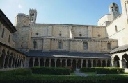
On the other hand, it is very interesting a visit to the monastery of Santa Maria, an old Benedictine monastery, of Romanesque style (11th and 12 th centuries), the most important and singular in the county.

 Enpoint: Sort — Hotel Pessets

We hope you enjoy this route!

For more information visit www.hotelpessets.com
Videos:

N-260 Eix Pirinenc & Coll de Nargó

Hotel Pessets&Spa, has the following proposal for you to enjoy both from driving and what our land can offer you:

This is a 453 km route that starts from Sort, following one of the best roads of the catalan pyrenees, the N-260.
It crosses a part of the the catalan Pyrenees in the province of Lleida and Girona. It is a intensive but popular and funny route, complemented by spectacular and different views.
If you are provisioned with a good supply of food and drink, this route will offer bikers the chance to enjoy the exhilarating experience of the catalan pyrenees in a single day. But if what you are searching for more relax and comfort, on the road there are many good restaurants with local cuisine.
 
As mentioned, the startpoint is in Sort — Hotel Pessets:

Sort, with its 2230 inhabitants, is the capital of the region.
Its main tourist attractions are its nature and the River Noguera Pallaresa, with adventure sports like white water rafting, canyoning, kayaking… It has also recently become famous for its lottery centre «La Bruixa d'Or» (Golden Witch), with many people stopping off here to try their luck.

Take the N-260 in direction La Seu d'Urgell getting thorugh the Port del Cantó mountain pass.
The Port del Cantó is a mountain pass of 1718.4 meters located at the border of the municipalities of Soriguera, the region of Pallars Sobira and Montferrer i Castellbò, the region 's Alt Urgell.

La Seu d'Urgell is the capital of the comarca Alt Urgell, head of the judicial district of la Seu d'Urgell and the seat of Bishop of Urgell, one of the Andorra co-princes. It is in the district of Alt Pirineu i Aran (High Pyrenees and Aran), and is the town with the most inhabitants, having 17.4% of the district population. La Seu d'Urgell and Puigcerdà together have 30% of the population of the area.

It is located at the confluence of the Segre and the Valira rivers. The city is in the local region of Urgellet, a Pyrenean region formed by 16 municipalities of Alt Urgell. Urgellet and Andorra were the originary County of Urgell with capital in la Seu d'Urgell before the county expansion to the south. Alt Urgell is the gateway to the state of Andorra and the proximity to this important population center and economic activity is largely one of the reasons for the current drive of the city of la Seu d'Urgell within Alt Pirineu i Aran.

The town's patron saints are Saint Ot of Urgell,[9] Saint Sebastian, and the Virgin of Urgell. While the Virgin of Núria and Sant Ermengol are the main patrons of the diocese of Urgell. Sant Ermengol is the most prominent in the city than other patrons. Probably that's why there are various events throughout the year dedicated to Sant Ermengol, such as the Sant Ermengol Fair, one of the oldest in Catalonia, and the altarpiece of Sant Ermengol.

The Parc Olímpic del Segre, built in 1992 for the Barcelona Summer Olympic Games, is a pump-driven canoe and kayak sports venue located adjacent to the historical centre of la Seu d'Urgell.


Bellver de Cerdanya is a town in the comarca of Cerdanya with 1.314 inhabitants.
Places of interest:
In Baltarga, the Romanesque church dedicated to St. Andrew (11th century, with two side chapels attached in 18th century);
In Bor, the Romanesque church dedicated to St. Marcellus (11th century);
in Coborriu de Bellver, the Romanesque church dedicated to St. Serni, first mentioned in the 10th century, suffered fire and destruction by the French in 1793 and during the Spanish Civil War in 1936; it was restored in 1967;
in Cortàs, the Romanesque church of St. Polycarp (12th century);
in Éller, the Romanesque church of Santa Eulalia (12th century);
in Pedra, the Romanesque church of Santa Julia, ransacked by the Albigensian in 1198 and modified in the 15th century after an earthquake;
in Pi, the Romanesque church of Santa Eulalia, vastly modified in the 18th century; only the lateral walls and the bell tower belong to the original structure;
in Sant Martí dels Castells, the Romanesque chapel of St. Martin built inside the castle; its slightly pointed vault was rebuilt during Gothic times;
in Santa Eugènia de Nerellà, the only original structure of the 10th century Romanesque church is the bell tower, heavily tilted towards southeast;
in Talló the 11th century Romanesque church of Santa Maria; its bell tower was built in the 17sup>th century;
in Talltendre, the 12th century Romanesque church of Sant Iscle and Santa Victoria; its bell tower was built later.


Puigcerdà  is the capital of the Catalan comarca of Cerdanya, in the province of Girona, near the river Segre and on the border with France (it abuts directly onto the French town of Bourg-Madame).

It is located near the site of a Ceretani settlement, which was incorporated into Roman territory. The Roman town was named Julia Libyca.
Puigcerdà was founded in 1178 by King Alfonso I of Aragon, Count of Barcelona. In 1178 Puigcerdà replaced Hix as the capital of Cerdanya. Hix is now a village in the commune of Bourg-Madame, in the French part of Cerdagne.
It was unique during the Spanish Civil War in having a democratically elected Anarchist council. The Portet-Saint-Simon–Puigcerdà railway was opened in 1929, crossing the Pyrenees to France.


Main sights:
Puigcerdà Pool
Torre del Campanar (12th century). It is the last remain of a parish church destroyed in 1936
Romanesque church of Sant Tomàs de Ventajola, known from 958
Romanesque church of Sant Andreu Vilallobent, dating to the 10th century and later restored
Convent of St. Dominic, founded in 1291 and finished in the 15th century
Old Hospital (1190), in Romanesque-Gothic style


Ribes de Freser is a municipality in the comarca of the Ripollès in Girona. It is situated at the confluence of the Freser, Rigard and Segadell rivers, 14 km (8.7 mi) north of Ripoll. It is known for its mineral water, paper manufacture and milk products, and is also an important tourist centre. A rack railway runs from the town to Queralbs and to the shrine of Núria, through the Vall de Núria. The town is on the communication route from Barcelona to Puigcerdà (N-152 road and RENFE railway line).

Ripoll is the capital of the comarca of Ripollès, in the province of Girona, Catalonia, Spain. It is located on confluence of the Ter River and its tributary Freser, next to the Pyrenees near the French border. The population was 11,057 in 2009.

The first traces of humans inhabiting the area date from the Bronze Age and can be seen in form of dolmens such as those found in El Sot de Dones Mortes or in Pardinella. This area was later used by peoples from the Atlantic culture to store bronze weapons and as a passway from the Catalan Central Depression to the Pyrenees. The area also has tombs from the late Roman occupation age and some belonging to the Visigoths.

It has a famous Benedictine monastery built in the Romanesque style, Santa Maria de Ripoll, founded by the count Wilfred the Hairy in 879. The count used it as a centre to repopulate the region after conquering it. In the High Middle Ages, its castle, the Castle of Saguardia, located in the county of Les Llosses was ruled by the Saguàrdia family, of which Ponç de la Guàrdia was a famous troubadour.

An abundance of coal and iron ore, coupled with the ample water supply of the rivers Ter and Freser, encouraged a metal-working industry in the early Middle Ages. The furnaces of Ripoll were a prime source of nails for the peninsula. Later, pole arms and crossbows, always in demand, were added to Ripoll’s exports. Ripoll enjoyed a reputation throughout Europe for the production of firearms. That success as a manufactory of firearms brought frequent trouble to the city. French invasions in 1794, 1809, 1812, and 1813 crippled the city industries. However, the final and utter destruction of Ripoll, resulting from mines and blasting, occurred in 1839 during the Carlist Wars. Due to the loss of records and archives, not much is known of Ripoll and its industry to this day.

Sant Joan de les Abadesses is a town and municipality located in the south-east of the comarca of Ripollès and it is located along the upper part of the River Ter, in the valley of the same name, and enclosed by the Serra Cavallera to the north and the mountain of Sant Antoni to the south. It has an inland, continental climate, with abundant precipitation and notable temperature variability.
Main sight: The city of Olot has a rich cultural heritage. There are several fine examples of Modernist architecture and the «Claustres del Carme», the Carmelite Cloisters, which date back to the Renaissance.
Monastery of Sant Joan de les Abadesses, founded in the late 9th century, with the current Romanesque complex built in the 12th century.
Pont Vell, or «Old Bridge», built in the medieval era and in the Gothic style.
Vila Vella, planned city built in the 13th century. It conserves its street layout, Main Square, and several houses from the 17th century.
Remains of the Medieval walls, including two extant towers, and parts of the wall itself.
«Way of Iron and Coal» (Ruta de Ferro i Carbó), a rail trail along the former railroad bed.


Olot is the capital city of the comarca of Garrotxa, in the Province of Girona. The city is known for its natural landscape, including four volcanoes scattered around the city center. The municipality is part of the Garrotxa Volcanic Zone Natural Park. Olot is also well-known for its cultural activity, with historical art movements like Olot school or imaginery schools, which contributed to the location in the city of the main Design and Arts & Crafts school of the province of Girona, the Escola d'Art i Superior de Disseny d'Olot.
With regard to painting and sculpture, the importance of the «Olot School» should not be left out. This artistic movement is well represented in the Museu Comarcal de la Garrotxa (the regional museum). Painting, sculpture and ceramics being the key elements in the art of Olot, not to mention the tradition of the Nativity Scenes or «pessebres» and the world famous sculptures of saints.
Nowadays the Olot Art School exists as a design and arts schools with the name of Escola d'Art i Superior de Disseny d'Olot and occupies the «Claustres del Carme» mentioned above.

Turn back to Ripoll taking the N-260a.
After Ripoll you will arrive to Borredà.
Borredà is a municipality in the comarca of the Berguedà. It is situated in the upper valley of the Margençol river in the east of the comarca. There are several notable houses from the 17th and 18th centuries. The Romanesque church of Sant Sadurní de Rotgers, a protected historico-artistic monument, can be reached by a mountain track. The village is served by the C-149 road between Berga and Sant Quirze de Besora. The municipality surrounds an exclave of Les Llosses.

Berga is the capital of the comarca of Berguedà.

Berga derives its name from the Bergistani, an Iberian tribe which lived in the area before the Roman conquest. The Bergistani were first subdued by Hannibal in 218 BC. They rebelled twice against the Romans and were twice defeated; after their second uprising, much of the tribe was sold into slavery. Livy mentions their principal town, Castrum Bergium, which was probably the precursor of the present-day town of Berga. It was ruled by viscounts in the Early Middle Ages and had its own counts from 988 and was sold to king Peter II of Aragon in 1199.
Berga is perhaps most famous for its traditional festival of «La Patum», a celebration which occurs every Corpus Christi, lasting for five days.
Valls is the capital of the comarca of Alt Camp, in Catalonia, Spain. According to the 2014 census it has a population of 24,570. This town is known for its calçots – a type of scallion or green onion – and the human towers tradition known as the castells. The town is the birthplace of the composer Robert Gerhard (1896–1970).
Valls is known for its culinary tradition, the feasting on calçots at what is known as a «calçotada». The calçots are a large type of sweet-flavoured spring onion, barbecued over a pit of flaming vines, and eaten piping hot with romesco sauce in gloved hands. The calçotada continues with a main course of meats and sausages grilled over the same glowing coals, and is washed down with locally produced wines. The calçots are only available between December and May and draw diners from as far away as Barcelona. The calçot is grown locally and has a «PGI» (Protected Geographical Indication) status in the same way that champagne does.

Another cultural tradition of Valls is the practice of building «castells» at festivals, pyramids of people sometimes as much as twelve individuals high, with each layer being supported by the people below.This human tower tradition originated in the Ball dels Valencians in Valls, first recorded in 1712, and later spread to nearby towns such as Vilafranca del Penedès and Tarragona, and more recently, to other parts of Catalonia.
The composer Roberto Gerhard was born in Valls in 1896. He studied under Charles Koechlin in Paris and under Arnold Schoenberg in Vienna and Berlin before returning to Barcelona in 1928. During the Spanish Civil War he supported the Republican cause and was forced to flee the country in 1939, first to Paris and then to England where he spent the rest of his life, meanwhile his town was bombing and a lot of republican and catholic citizens killed. His works were virtually banned from performance in Spain under Francisco Franco. His output included symphonies, stage works, chamber music, choral music and electronic music.
Coll de Nargó is a municipality in the comarca of the Alt Urgell in Catalonia. It is situated in the Segre valley by the Oliana reservoir. The municipality is served by the C-14 road between Ponts and La Seu d'Urgell, the L-511 road to Isona and the L-401 road to Sant Llorenç de Morunys. The Romanesque church of Sant Climent dates from the eleventh century, and has a rectangular pre-Romanesque bell-tower.


Isona i Conca Dellà is a municipality in the comarca of the Pallars Jussà. It is situated in the valley of the Conques river in the south-east of the comarca. It was formed in 1970 by the fusion of the following municipalities: Isona, Basturs, Benavent de la Conca, Biscarri, Conques, Covet, Gramenet, Llordà, Masos de Sant Martí, Montodó, Orcau i Figuerola d'Orcau, Sant Romà d'Abella and Siall. The town hall is in Isona. The municipality is served by the C-1412 road between Artesa de Segre and Tremp, and is linked to Coll de Nargó by the L-511. It includes a small exclave to the south.

The church of Santa Maria in Covet and Llordà castle are protected historico-artistic monuments.
Tremp is the capital of the comarca of the Pallars Jussà. It is the largest municipality in Catalonia in terms of area (303.97 km²), accounting for nearly a quarter of the total area of the comarca. The municipality is a geographical oddity and consists of five separate territorial entities within the comarca (district) of Pallars Jussa. The town of Tremp (population 6228 as of 2009) is the second smallest of these and is situated in the valley of the Noguera Pallaresa river below Talarn and the Talarn Dam. The largest portion of the municipal territory lies to the west of the valley of the Noguera Pallaresa and stretches as far as the Noguera Ribagorçana river. A third portion is an exclave of the comarca within the municipality of el Pont de Suert in the Alta Ribagorça. In the east the villages of Palau de Noguera, Suterranya and Vilamitjana form the fourth entity, while the fifth and smallest portion (of only 1,59 km2) is formed by the village of Puigcercós, south of Tremp.
The town is served by the C-13 road which runs along the valley of the Noguera Pallaresa.
La Pobla de Segur is  located in the comarca of Pallars Jussà. According to the 2013 census (INE), the town has a population of 3,073 inhabitants. It is situated at the confluence of the Flamicell and Noguera Pallaresa rivers in the north of the comarca, above the Sant Antoni reservoir. It is an important local service centre, which has allowed it to escape the depopulation which has affected many municipalities in northwestern Catalonia. The village is served by the C-13 road between Tremp and Sort, the N-260 road to Pont de Suert and by a railway station on a railway line to Lleida.

Famous people from La Pobla de Segur include FC Barcelona player Carles Puyol and 22nd President of the European Parliament Josep Borrell.
From la Pobla de Segur to Gerri de la Sal you can also make a visit to the 5 km-long «Congost de Collegats» (Collegats pass), which has been carved out of the landscape by the River Noguera Pallaresa. One of the most characteristic elements of this gorge is L'Argenteria, which is said to have inspired the architect Antoni Gaudí when he designed façade of La Pedrera, in Barcelona.


Gerri de la Sal is the administrative center of the municipality and home to the medieval monastery of Santa Maria de Gerri:
On the one hand, you have the salt works and the salt warehouse, or Alfolí, ( in this moment ypu can't visited, is in rebuilding) to know more about its production process, its transformation, storage and commercialisation of salt. The salt works have always given some special features to the village of Gerri, and the exploitation of its salted water fountain by evaporation has become the main economic drive to the village for many years.
From 6th June in 1995, by unanimity, Gerri de la Sal is agreed to declare it a National Human Heritage (Bé Cultural d’Interès Nacional), the salt l’Alfolí, is the biggest civil building on a whole base plant in all the region of El Pallars. Its has received such category, both the warehouse and the salt works, due to its architectural, historical and cultural, proved to deserve such a cultural protection.
On the other hand, it is very interesting a visit to the monastery of Santa Maria, an old Benedictine monastery, of Romanesque style (11th and 12 th centuries), the most important and singular in the county.

 Enpoint: Sort — Hotel Pessets

We hope you enjoy this route!

For more information visit www.hotelpessets.com

Carrer de Fontanella, 10, Olot, Spain

Carrer Agustí Muxí i Monroset, N-260, Sort, Spain

N-260, Arfa, Spain

N-260a, la Seu d'Urgell, Spain

Eix Pirinenc, N-260, el Pont de Bar, Spain

Eix Pirinenc, N-260, Prullans, Spain

Eix Pirinenc, N-260, Bellver de Cerdanya, Spain

Eix Pirinenc, N-260, Ger, Spain

N-260 Eix Pirinenc, N-260, Sant Martí d'Aravó, Spain

Eix Pirinenc, N-260, Fontanals de Cerdanya, Spain

Eix Pirinenc, N-260, Ribes de Freser, Spain

Eix Pirinenc, N-260, Ribes de Freser, Spain

Carrer Ciutat Jardí, Ripoll, Spain

N-260a, Vallfogona de Ripollès, Spain

Carrer Bac de Mel, Ripoll, Spain

Carretera de Ripoll, C-26, les Llosses, Spain

Carretera de Ripoll a Berga, C-26, Vilada, Spain

LV-4241, Guixers, Spain

LV-4241, Guixers, Spain

LV-4241, Guixers, Spain

Eix Salou - Andorra C-14, C-14, Coll de Nargó, Spain

Avinguda de l'Alcalde Altisent, C-1412b, Tremp, Spain

Carrer Agustí Muxí i Monroset, N-260, Sort, Spain

Leave a comment
Delete this tour?
 
No
 
Yes
Upgrade to
PRO
Ride your dream
tours with Tourstart
  • Download to GPS 

  • Navigate using the Android app 

  • Navigate using the iPhone app 

USD 29
each
PER YEAR
more...
You are recommended to update to the latest version of Internet Explorer.
To assure all functions on Tourstart are working correct, we recommend you to upgrade your browser, or use one of the other browsers: