display:none;">
Subscribe to TourNews

  • 554 Users viewed this
  • 0
    Download GPS data (0 downloads)
  • Full map view
  • Plan in RidePlan
  • Reverse tour
  • Show distance and time
  • Show distances
  • Show the entire Tour on the map
  • Download PDF
  • Print actual view
  • Ride with friends
    Let us ride this tour on:
    Add some friends so you can share the tour with them
  • 0
    E-mail GPX file
    Please add some friends so you can send the GPX file of tour to them
    Send copy to me
  • Report
  • Embed
Scenic
Mountain
Seaside
Twisted
Straight
Duration:
3h 46 min
Distance:
94 mile
Rating:
Website:
http://
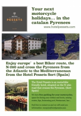
 Hotel Pessets&Spa, has the following proposed for you to enjoy both from driving and what our land can offer you:

This is a 151 km route that starts from Sort, takes you through the valleys of the Pallars Sobirà.
If you are provisioned with a good supply of food and drink, this route will offer bikers the chance to enjoy the exhilarating experience of the catalan pyrenees in a single day. But if what you are searching for more relax and comfort, on the road there are many good restaurants with local cuisine. We will mention restaurants below.

As mentioned, the startpoint is in Sort — Hotel Pessets:

Sort, with its 2230 inhabitants, is the capital of the region.
Its main tourist attractions are its nature and the River Noguera Pallaresa, with adventure sports like white water rafting, canyoning, kayaking… It has also recently become famous for its lottery centre «La Bruixa d'Or» (Golden Witch), with many people stopping off here to try their luck.

Take the C-13 in direction Llavorsí, following the Noguera Pallaresa countercurrent.

Llavorsí is a village that was built literally embedded between mountains and it is divided by the Noguera Pallaresa. There's where most activities, like rafting, have its start point.

In Llavorsí take the L-510, it will get you to Tirvia.

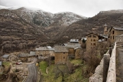
Tírvia is set on a high plateau, as if it were a watchtower, at the river-crossing of the three valleys, a special situation from which the village takes its name and profile: Tírvia, meaning three ways. Due to the strategic quality of the settlement, in the past the place was totally enclosed inside walls and went through much hardship at war times through the centuries. It was precisely because of this privileged situation that it was almost brought to ashes during the Spanish Civil War. The church of La Mare de Déu de la Pietat and the old chapel of St. Joan Baptista are worth visiting, as well as the funerary tablets. Every year, during the summertime, the village holds a Painting Contest of quite a certain prestige, and, on Easter Celebrations, the traditional parade of Els Armats (Roman soldiers) marches on the streets.

The next village is Farrera, a township that includes the mountain range of Burg and the largest part of the right slope in the Romadriu valley, whose name comes from the river that borders the southern limit of the township. The peak of Màniga (2.515 ms) separates it from the township of Vall Ferrera.

The Vall Ferrera and the Vall de Tor are the main components of the municipality of Alins. It has a long timed tradition for hiking and mountain activities, such as mountain ski, climbing, etc. One of the borders of the area is la Pica d’Estats, a peak 3.143 m high, which makes it the ceiling of Catalonia. However, there are other important summits: the Monteixo (2.905 m), the Baborte (2.938 m), the Salòria (2.789 m), the Norís (2.834 m), etc. Apart from these, there are also many lakes and ponds (Sotllo, Baborte, Baiau) and mountain refuges as the Vallferrera (FEEC), the one in Baborte (UEC) and the one in Baiau (FEEC), as well as many bordes (sheds). The restoration works promoted by the Association for the Patrimony of la Vall Ferrera (founded in 1983) have perhaps kept in good conditions many of the buildings that are considered remarkable for their historic-artistic and architectonic interest: the pre Romanesque church of Sant Feliu, the architectonic site of La Força d'Àreu, the Colomer and the Prison of the Tower in Alins, the church of Santa Maria de la Torre, the hermitages of Sant Quirc d'Alins, Sant Francesc d'Arós (the most ancient hermitage in El Pallars), etc. Within the limits of the township of Alins there are the Entitats Municipals Descentralitzades (municipal and decentralised entities) of Àreu, Araós and Ainet de Besan.

To get to the next valley, get back to Llavorsí and take the L-504 direction Ribera de Cardós.

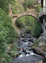
The «Vall de Cardós»  has this name from before the 19th century. After that, there were some modifications so that each village had its own name. From the year 1970, the region is named Ribera de Cardós. The township, long shaped, extends all along the southwest of the valley that bears the same name. There is the remarkable parish church of St. Maria de Ribera, in the Romanesque style, with an outstanding belfry set in a square plant; a magnificent cross of bordres from the 15th century, marking the limit of the region; also, the Romanesque bridges of Cassibrós and of La Mare de Déu del Pont and some large country houses as Casa Mill o Casa Pubill. It is also an excellent point, especially from a tourist point of view, thanks to the ideal physical conditions that the valley offers, and it has as well as an important wood transformation industry.

The village ofLladorre borders the French country of Foix. It is the head of the Valley of Cardós, and it is locked in the north by the dividing range of Central Pyrenees, from Mont-roig, westerly, to the Peak of Sotllo, crossing the Pass of Tavascan and the Pass of Lladorre, towards the north of Tuca de Salibarri. Between 2,200 and 2,500 m high, an incredible amount of lakes fill in the over excavated ground of the main benches –among those lakes, the largest one in Catalonia, the lake of Certascan. The lakes are drained by the many courses of the river Lladorre, which downstream is called la Noguera de Cardós. The main vegetation above 2.000 m is fescue of the Pyrenean pastures, only in the places where stony screes let them grow. On the sub alpine layer, the mountain pine grows abundantly, but on the more humid areas beech trees substitute it. The cross-country ski resort of Tavascan is also in the township.

Tavascan  lies in the valley approximately 8 kilometres from the French border and 16 kilometres from the Andorran border. Tavascan is situated on a slope 1122 metres above sea level. In the village there are three hotels and one restaurant that serve tourists drawn to the area by the surrounding valleys and ski slopes of Tavascan Pleta del Prat.

The small river of Tavascan runs through the centre of the village, and flows into the Pantà de Tavascan, which flows into the river of Lladorre.

Attractions in Tavascan include the village church of Saint Bartholomew.

Tavascan is the location of the end of the main L-504 road, which continues as small forest tracks.

Next stop will be the «Vall d'Assua», you have to get back to Sort and then take the  LV-5223 — carretera de Sort a LLessui.

The township of Sort includes the traditional township of Sort, and also the villages of Llessui and Enviny, annexed in 1970, and the ones in Altron, annexed in 1976. The township stretches along the riverbank in Sort, the valley of the ravine of Montardit and practically the whole valley of Àssua. Thus, the township consists of the town of Sort, head of the municipality and traditional capital of El Pallars Sobirà, the villages of Altron, Bernui, Enviny, Llarvén, Llessui, Montardit de Dalt, Olp, Ribera de Montardit, Saurí, Sorre, la Bastida, Pujalt, Bressui, the Masos de Castellviny, the deserted village of Pernui and the old places of la Torre, Torena and Menauri. The ancient centre of the town is woven by narrow streets, alleys and old houses, gathering around a rocky buttress, together with the round-based large towers of the castle in Sort, its Gothic façade (15th century) and the walls–reconstructed in 1842 as part of the graveyard gates -, ancient dwelling of the counts of Pallars. From 1491, it became the house of the governors administrating the marquisate of Pallars, on behalf of the Cardona House. The village spread around this construction, following the path that headed to the river, through the main road (Carrer Major) and the suburb. In the beginning of the 20th century, while building the road from Balaguer to the Valley of Àneu, the river was diverted and a new neighbourhood flourished incorporating the avenue, Passeig de la Pallissa, which used to be on the bank of the river. Through the years the avenue has become the village shopping centre and meeting point. The village of Sort is already mentioned in 1069 as a possession of the county of Urgell. Sort is widely famous as the capital of extreme sports and also because of the lottery office in the village, called La Bruixa d'Or (the Golden Witch). In the last few years, it has sold many important prizes. It started as a small lottery administration and the reason why it has given so many big prizes is barely know, but it has certainly become a mandatory stop for tourists, who come to buy lottery tickets at any time through the year. The inhabitants of Sort are called «neros».


Llessuí is the highest village in the Àssua Valley 12 km from Sort, it belongs to the same municipality.

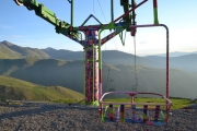
A 1 km from the village, is where once were the ski slopes, opened in 1966, and today remain closed since 1987. Continually arise rumors about its opening, since it was and could be a great season with plenty of snow, stunning views of the Catalan Pyrenees and because at the time fueled the economic development of the region.
«Pallaresian» cuisine in «Lo Pigal» or, as the inhabitants know it «Casa Kiko», natural landscapes, pure nature… there are many elements that make this village an ideal resting place.
Recently in Llessui has proceeded to the opening of the «Casa del Pastor» (located in the premises of the old school Llessui), Museum of the Generalitat de Catalunya in which we can learn a lot about the area, the customs of the people and like the shepherds from ancient times until today they have developed their activity. Once again, an essential place to visit.

Pujalt, sometimes referred to as The Pujalt and sometimes graphing Pujals is a village in the municipality of Sort, in the region culd. Until 1976 it was part of the term of Enviny. Pujalt is to the northwest of its present municipal head, Sort, right from the source Llessiu ravine.
Pujalt is an elongated village on a spur that rises up on the right bank of the canyon called «Barranc de la Font de Llessiu» and its off Eastern and Southern sides, in addition to the north. Everything is grouped, forming an almost closed with a pair of irregular streets.
There is the Butterfly Museum of Catalonia in the towncenter, the old school (which carried out the filming of some scenes of «The voices Pamano»), while the church of San Pedro is in the extreme northwest of the small town.


Enviny is to the west of its present municipal head, Sort, perched in the mountains that enclose the valley to the right of the Noguera Pallaresa. It is on the southern slope of the ridge to the south-east end of «Serrat dels Plans», left, quite elevated, the canyon «Barranco de Montardit». It is near and to the east-northeast Llarvén and a little further north of Montardit de Dalt. It is located to the left of the Llau of Toscas at the foot of the Coma Hills.
The parish church of Our Lady of Candlemas Enviny currently Purification of the headquarters of a group of parishes, in addition to the chapels and shrines of San Miguel and San Roque in the surroundings of the town, as well as the private chapel of Santa Lucia Casa Aytés within the core Enviny.

Llarvén, often graphing Llarvent, is a village that until 1976 was part of the term of Enviny. It is to the northwest of its present municipal head, Sort, perched in the mountains that enclose the valley to the right of the Noguera Pallaresa. Located on a ridge to the right of the Llau Caranta then left the ravine Montardit.
In addition to the church of Santa Coloma, in the surroundings of the town is the chapel of the Rosary and the old church of Santa Creu.

Montardit de Dalt, often simply called the name of former Montardit, especially since Montardit de Baix also called «Ribera de Montardit», is a town in the municipality of Sort. Until 1976 it was part of the term of Enviny. Montardit de Dalt is in the southwest of its present municipal head, Sort, perched in the mountains that mark the right bank of the Noguera Pallaresa. It is located to the left of the canyon «Barranco de Montardit». To the west of the town is the house and barks of Santa Cruz, the old church of Enviny. Montardit is a medieval Romanesque name. Joan Corominas explained from the composition of «Monte» (mountain) and «bold» (brave). The second part of the name, «de Dalt» is referring to the Montardit de Baix extension in the plane of the original population, initially from about Inns road. The tagline «de Dalt» is back in the name of «Montardit» without complement, with which the people formerly designated.

We hope you enjoyed the different valleys of the Pallars Sobirà!

Endpoint: Sort — Hotel Pessets

For more information info@hotelpesset.com or visit www.hotelpessets.com
Videos:

Valleys of the Pallars Sobirà

 Hotel Pessets&Spa, has the following proposed for you to enjoy both from driving and what our land can offer you:

This is a 151 km route that starts from Sort, takes you through the valleys of the Pallars Sobirà.
If you are provisioned with a good supply of food and drink, this route will offer bikers the chance to enjoy the exhilarating experience of the catalan pyrenees in a single day. But if what you are searching for more relax and comfort, on the road there are many good restaurants with local cuisine. We will mention restaurants below.

As mentioned, the startpoint is in Sort — Hotel Pessets:

Sort, with its 2230 inhabitants, is the capital of the region.
Its main tourist attractions are its nature and the River Noguera Pallaresa, with adventure sports like white water rafting, canyoning, kayaking… It has also recently become famous for its lottery centre «La Bruixa d'Or» (Golden Witch), with many people stopping off here to try their luck.

Take the C-13 in direction Llavorsí, following the Noguera Pallaresa countercurrent.

Llavorsí is a village that was built literally embedded between mountains and it is divided by the Noguera Pallaresa. There's where most activities, like rafting, have its start point.

In Llavorsí take the L-510, it will get you to Tirvia.

Tírvia is set on a high plateau, as if it were a watchtower, at the river-crossing of the three valleys, a special situation from which the village takes its name and profile: Tírvia, meaning three ways. Due to the strategic quality of the settlement, in the past the place was totally enclosed inside walls and went through much hardship at war times through the centuries. It was precisely because of this privileged situation that it was almost brought to ashes during the Spanish Civil War. The church of La Mare de Déu de la Pietat and the old chapel of St. Joan Baptista are worth visiting, as well as the funerary tablets. Every year, during the summertime, the village holds a Painting Contest of quite a certain prestige, and, on Easter Celebrations, the traditional parade of Els Armats (Roman soldiers) marches on the streets.

The next village is Farrera, a township that includes the mountain range of Burg and the largest part of the right slope in the Romadriu valley, whose name comes from the river that borders the southern limit of the township. The peak of Màniga (2.515 ms) separates it from the township of Vall Ferrera.

The Vall Ferrera and the Vall de Tor are the main components of the municipality of Alins. It has a long timed tradition for hiking and mountain activities, such as mountain ski, climbing, etc. One of the borders of the area is la Pica d’Estats, a peak 3.143 m high, which makes it the ceiling of Catalonia. However, there are other important summits: the Monteixo (2.905 m), the Baborte (2.938 m), the Salòria (2.789 m), the Norís (2.834 m), etc. Apart from these, there are also many lakes and ponds (Sotllo, Baborte, Baiau) and mountain refuges as the Vallferrera (FEEC), the one in Baborte (UEC) and the one in Baiau (FEEC), as well as many bordes (sheds). The restoration works promoted by the Association for the Patrimony of la Vall Ferrera (founded in 1983) have perhaps kept in good conditions many of the buildings that are considered remarkable for their historic-artistic and architectonic interest: the pre Romanesque church of Sant Feliu, the architectonic site of La Força d'Àreu, the Colomer and the Prison of the Tower in Alins, the church of Santa Maria de la Torre, the hermitages of Sant Quirc d'Alins, Sant Francesc d'Arós (the most ancient hermitage in El Pallars), etc. Within the limits of the township of Alins there are the Entitats Municipals Descentralitzades (municipal and decentralised entities) of Àreu, Araós and Ainet de Besan.

To get to the next valley, get back to Llavorsí and take the L-504 direction Ribera de Cardós.

The «Vall de Cardós»  has this name from before the 19th century. After that, there were some modifications so that each village had its own name. From the year 1970, the region is named Ribera de Cardós. The township, long shaped, extends all along the southwest of the valley that bears the same name. There is the remarkable parish church of St. Maria de Ribera, in the Romanesque style, with an outstanding belfry set in a square plant; a magnificent cross of bordres from the 15th century, marking the limit of the region; also, the Romanesque bridges of Cassibrós and of La Mare de Déu del Pont and some large country houses as Casa Mill o Casa Pubill. It is also an excellent point, especially from a tourist point of view, thanks to the ideal physical conditions that the valley offers, and it has as well as an important wood transformation industry.

The village ofLladorre borders the French country of Foix. It is the head of the Valley of Cardós, and it is locked in the north by the dividing range of Central Pyrenees, from Mont-roig, westerly, to the Peak of Sotllo, crossing the Pass of Tavascan and the Pass of Lladorre, towards the north of Tuca de Salibarri. Between 2,200 and 2,500 m high, an incredible amount of lakes fill in the over excavated ground of the main benches –among those lakes, the largest one in Catalonia, the lake of Certascan. The lakes are drained by the many courses of the river Lladorre, which downstream is called la Noguera de Cardós. The main vegetation above 2.000 m is fescue of the Pyrenean pastures, only in the places where stony screes let them grow. On the sub alpine layer, the mountain pine grows abundantly, but on the more humid areas beech trees substitute it. The cross-country ski resort of Tavascan is also in the township.

Tavascan  lies in the valley approximately 8 kilometres from the French border and 16 kilometres from the Andorran border. Tavascan is situated on a slope 1122 metres above sea level. In the village there are three hotels and one restaurant that serve tourists drawn to the area by the surrounding valleys and ski slopes of Tavascan Pleta del Prat.

The small river of Tavascan runs through the centre of the village, and flows into the Pantà de Tavascan, which flows into the river of Lladorre.

Attractions in Tavascan include the village church of Saint Bartholomew.

Tavascan is the location of the end of the main L-504 road, which continues as small forest tracks.

Next stop will be the «Vall d'Assua», you have to get back to Sort and then take the  LV-5223 — carretera de Sort a LLessui.

The township of Sort includes the traditional township of Sort, and also the villages of Llessui and Enviny, annexed in 1970, and the ones in Altron, annexed in 1976. The township stretches along the riverbank in Sort, the valley of the ravine of Montardit and practically the whole valley of Àssua. Thus, the township consists of the town of Sort, head of the municipality and traditional capital of El Pallars Sobirà, the villages of Altron, Bernui, Enviny, Llarvén, Llessui, Montardit de Dalt, Olp, Ribera de Montardit, Saurí, Sorre, la Bastida, Pujalt, Bressui, the Masos de Castellviny, the deserted village of Pernui and the old places of la Torre, Torena and Menauri. The ancient centre of the town is woven by narrow streets, alleys and old houses, gathering around a rocky buttress, together with the round-based large towers of the castle in Sort, its Gothic façade (15th century) and the walls–reconstructed in 1842 as part of the graveyard gates -, ancient dwelling of the counts of Pallars. From 1491, it became the house of the governors administrating the marquisate of Pallars, on behalf of the Cardona House. The village spread around this construction, following the path that headed to the river, through the main road (Carrer Major) and the suburb. In the beginning of the 20th century, while building the road from Balaguer to the Valley of Àneu, the river was diverted and a new neighbourhood flourished incorporating the avenue, Passeig de la Pallissa, which used to be on the bank of the river. Through the years the avenue has become the village shopping centre and meeting point. The village of Sort is already mentioned in 1069 as a possession of the county of Urgell. Sort is widely famous as the capital of extreme sports and also because of the lottery office in the village, called La Bruixa d'Or (the Golden Witch). In the last few years, it has sold many important prizes. It started as a small lottery administration and the reason why it has given so many big prizes is barely know, but it has certainly become a mandatory stop for tourists, who come to buy lottery tickets at any time through the year. The inhabitants of Sort are called «neros».


Llessuí is the highest village in the Àssua Valley 12 km from Sort, it belongs to the same municipality.

A 1 km from the village, is where once were the ski slopes, opened in 1966, and today remain closed since 1987. Continually arise rumors about its opening, since it was and could be a great season with plenty of snow, stunning views of the Catalan Pyrenees and because at the time fueled the economic development of the region.
«Pallaresian» cuisine in «Lo Pigal» or, as the inhabitants know it «Casa Kiko», natural landscapes, pure nature… there are many elements that make this village an ideal resting place.
Recently in Llessui has proceeded to the opening of the «Casa del Pastor» (located in the premises of the old school Llessui), Museum of the Generalitat de Catalunya in which we can learn a lot about the area, the customs of the people and like the shepherds from ancient times until today they have developed their activity. Once again, an essential place to visit.

Pujalt, sometimes referred to as The Pujalt and sometimes graphing Pujals is a village in the municipality of Sort, in the region culd. Until 1976 it was part of the term of Enviny. Pujalt is to the northwest of its present municipal head, Sort, right from the source Llessiu ravine.
Pujalt is an elongated village on a spur that rises up on the right bank of the canyon called «Barranc de la Font de Llessiu» and its off Eastern and Southern sides, in addition to the north. Everything is grouped, forming an almost closed with a pair of irregular streets.
There is the Butterfly Museum of Catalonia in the towncenter, the old school (which carried out the filming of some scenes of «The voices Pamano»), while the church of San Pedro is in the extreme northwest of the small town.


Enviny is to the west of its present municipal head, Sort, perched in the mountains that enclose the valley to the right of the Noguera Pallaresa. It is on the southern slope of the ridge to the south-east end of «Serrat dels Plans», left, quite elevated, the canyon «Barranco de Montardit». It is near and to the east-northeast Llarvén and a little further north of Montardit de Dalt. It is located to the left of the Llau of Toscas at the foot of the Coma Hills.
The parish church of Our Lady of Candlemas Enviny currently Purification of the headquarters of a group of parishes, in addition to the chapels and shrines of San Miguel and San Roque in the surroundings of the town, as well as the private chapel of Santa Lucia Casa Aytés within the core Enviny.

Llarvén, often graphing Llarvent, is a village that until 1976 was part of the term of Enviny. It is to the northwest of its present municipal head, Sort, perched in the mountains that enclose the valley to the right of the Noguera Pallaresa. Located on a ridge to the right of the Llau Caranta then left the ravine Montardit.
In addition to the church of Santa Coloma, in the surroundings of the town is the chapel of the Rosary and the old church of Santa Creu.

Montardit de Dalt, often simply called the name of former Montardit, especially since Montardit de Baix also called «Ribera de Montardit», is a town in the municipality of Sort. Until 1976 it was part of the term of Enviny. Montardit de Dalt is in the southwest of its present municipal head, Sort, perched in the mountains that mark the right bank of the Noguera Pallaresa. It is located to the left of the canyon «Barranco de Montardit». To the west of the town is the house and barks of Santa Cruz, the old church of Enviny. Montardit is a medieval Romanesque name. Joan Corominas explained from the composition of «Monte» (mountain) and «bold» (brave). The second part of the name, «de Dalt» is referring to the Montardit de Baix extension in the plane of the original population, initially from about Inns road. The tagline «de Dalt» is back in the name of «Montardit» without complement, with which the people formerly designated.

We hope you enjoyed the different valleys of the Pallars Sobirà!

Endpoint: Sort — Hotel Pessets

For more information info@hotelpesset.com or visit www.hotelpessets.com

L-504, Lladorre, Spain

Avinguda de la Diputació, Sort, Spain

Avinguda Flora Cadena, C-13, Rialp, Spain

L-504, Llavorsí, Spain

Carretera de Llavorsí a Tavascan, L-504, Tírvia, Spain

L-510, Tírvia, Spain

Carrer de la Vila, Tírvia, Spain

Carretera de Tírvia a Farrera, Farrera, Spain

Farrera, Farrera, Spain

L-510, Tírvia, Spain

Carrer de Sant Roque, Alins, Spain

L-510, Alins, Spain

Carretera de Llavorsí a Tavascan, L-504, Tírvia, Spain

Carretera de Llavorsí a Tavascan, L-504, Vall de Cardós, Spain

Carretera de Llavorsí a Tavascan, L-504, Esterri de Cardós, Spain

C-13, Llavorsí, Spain

Ctra. de Sort a Llessui, LV-5223, Sort, Spain

Carrer Major, Altron, Spain

Sorre, Sort, Spain

Llessui, Sort, Spain

Carretera d'Olp, LV-5224, Sort, Spain

Carretera d'Olp, LV-5224, Sort, Spain

Carretera d'Olp a Enviny, Sort, Spain

Carretera de Sort a Enviny, LV-5222, Sort, Spain

Carretera de Sort a Enviny, LV-5222, Sort, Spain

Carretera de Sort a Enviny, LV-5222, Sort, Spain

Eix Pirinenc, N-260, Sort, Spain

Carrer Agustí Muxí i Monroset, N-260, Sort, Spain

Leave a comment
Delete this tour?
 
No
 
Yes
Upgrade to
PRO
Ride your dream
tours with Tourstart
  • Download to GPS 

  • Navigate using the Android app 

  • Navigate using the iPhone app 

USD 29
each
PER YEAR
more...
You are recommended to update to the latest version of Internet Explorer.
To assure all functions on Tourstart are working correct, we recommend you to upgrade your browser, or use one of the other browsers: